In preparation for a Mount Whitney hike, my son and I hiked from Horseshoe Meadows to Cottonwood Lakes #4 and 5. As an out and back trip, this was close to 13 miles, with around a thousand feet of elevation gain. This doesn’t sound like much, but the trailhead was already at 10,000 or so feet above sea level.
Starting from Lone Pine, the nearest town, most of the elevation gain up to that 10,000 foot level was done via car. From Highway 395, we drove down narrow roads until we began the ascent. The road winds up multiple switchbacks, many of them visible from the highway. After around 40 minutes of driving we reached the campground. Here we found a single parking spot open. There were multiple signs about bear activity. Many of the campsites were taken, but this is also a staging area for people hiking northbound along the John Muir Trail to Mount Whitney (or beyond, though I suspect many hikers on that trail get a shuttle from Lone Pine).
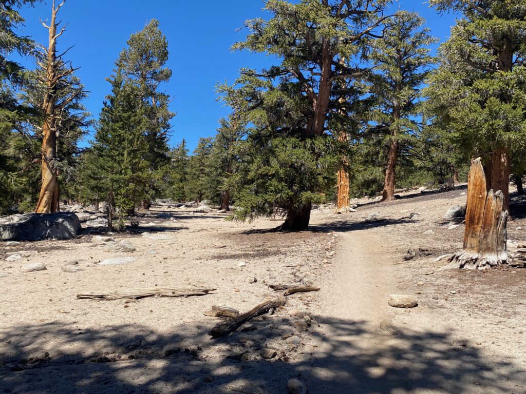
The terrain is mostly flat for the first couple of miles. There are trees, and the ground is dusty, gray. In early August the temperature was already in the 80s F, with almost no cloud cover that day. We started our hike around noon, after getting our Whitney Permit signed and looking around the visitor center (as well as dealing with a battery issue on the nearly brand new rental car). Along the way we passed many people returning from caping or hiking. We also ran into a group that was planning to hike the New Army Pass and then onward to Whitney. They planned to summit the same day as our Whitney Permit, and we left them with a “see you at the top” hail, being then full of confidence.
Slightly after two miles, the ascent begins. It’s only a short one, and we reached the top after a few short breaks, all cut short due to mosquitos. Along the way we marveled at the many meadows and wonderful scenery. Yes, it’s rocky and dusty, but the Eastern Sierras are a marvel to behold. The trail is well-marked and appears quite popular.
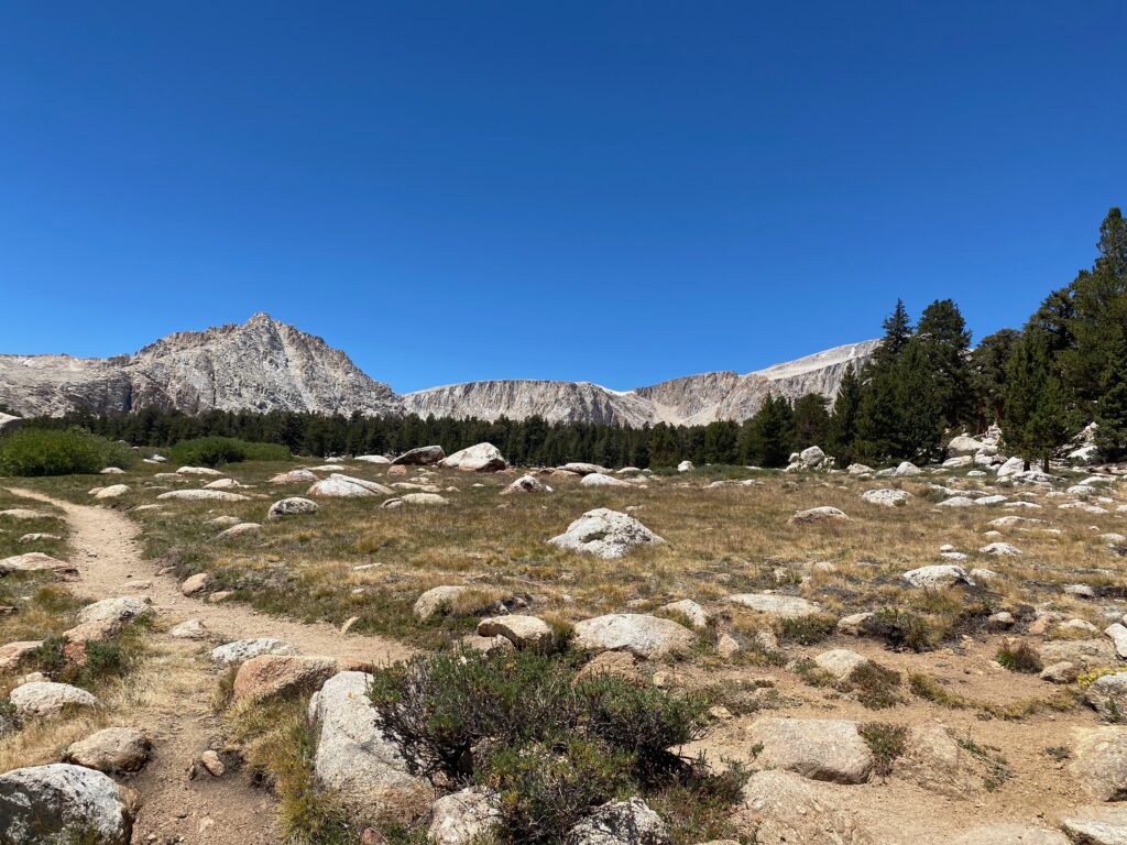
At the top of the climb, the trail is fairly flat. We passed the first couple of Cottonwood Lakes, then saw the wonder of Cottonwood Lake #3, the largest of the five such named lakes. At the far end there’s a small waterfall. Near the trail as it approached the lake, we founded a shaded spot and rested for lunch. We saw several people walking back from the lake, or continuing along the trail beyond the waterfall.
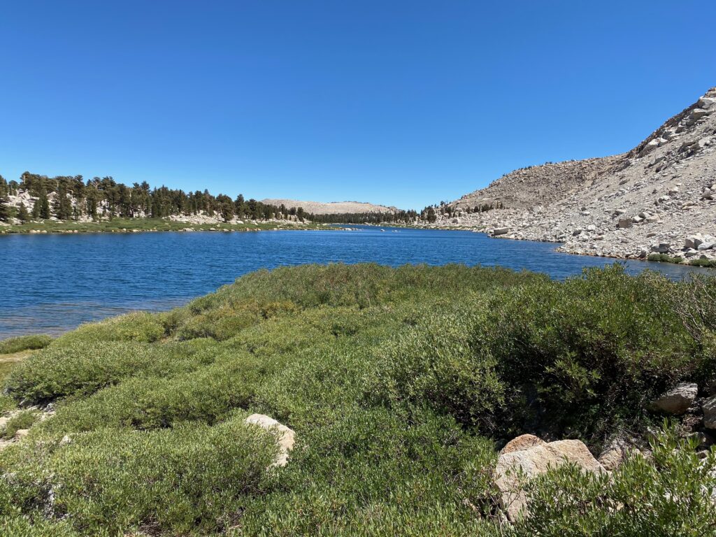
After our break we walked over to the waterfall, then walked up a short distance to the final two lakes. The Old Army Pass trail lies between lakes #4 and 5. We stood there and saw no trail, so we wondered how anyone would make it up that pass. On the way back, we did speak to someone who planned to camp near those two lakes and go up the Old Army Pass, so I guess it’s still possible.
Going downhill is so much better, and we quickly passed groups of people that we’d seen leaving half an hour or more before our walk to the last two lakes. We reached the trailhead in daylight, but figured some of the people that we’d passed likely would arrive there after dark, based on their pace. For our first day at altitude, this seemed like a great hike. Mount Whitney lay three days in the future, and as we drove back down the switchbacks we thought it would be just as easy as Cottonwood Lakes. Reality would prove different.