Lost worlds and ports of call

Category: hiking (Page 1 of 2)

Hiking in Arizona

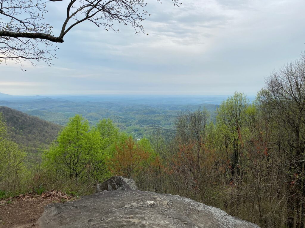
Arizona is an interesting state when it comes to geography. From its southern border with Mexico to north of Phoenix it’s a desert environment. An hour north of Phoenix you climb into the “high desert.” An hour or so past that point you reach even higher elevations. Flagstaff, Sedona, and the elephant in the state—the Grand Canyon itself—mark a different environment entirely.

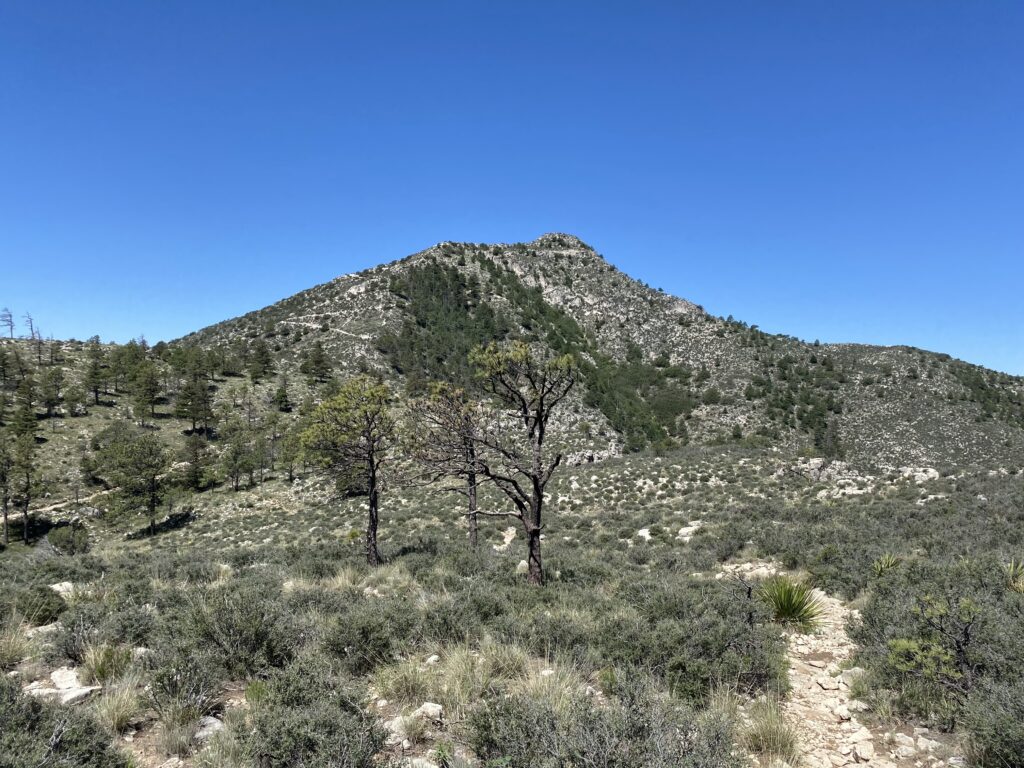
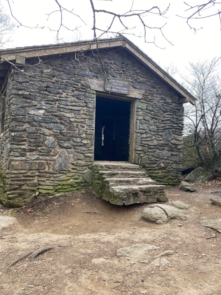
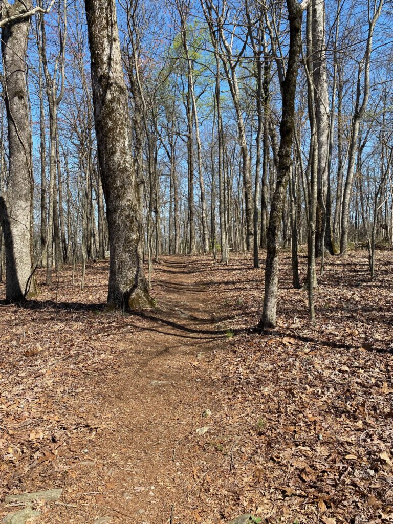
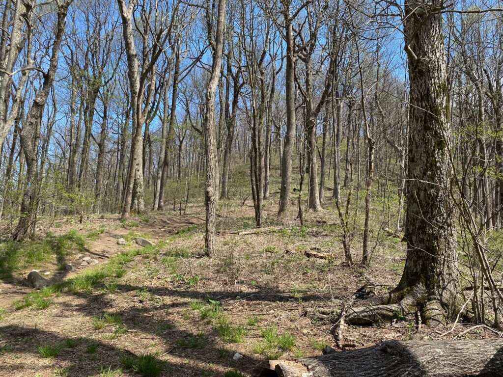
In early October I hiked a few miles in three locations near and in the Grand Canyon. The first foray was along a trail north of Flagstaff, a trail that intersected with and followed the Arizona trail, a trail that runs the length of the state from north to south, or south to north. This well-marked trail seemed more popular with mountain bikers than hikers, at least when I was there. It’s a place I’d like to spend more time exploring, but that day I only had time for a few miles out and back.

Along the trail we saw tall junipers, aspen, and a few alligator junipers. At least, that’s what I think they’re called. It’s a dry trail, despite following a riverbed, so bring lots of water. Flagstaff has a fair amount of nearby trails, and I picked a couple at random, then went for the northern one.

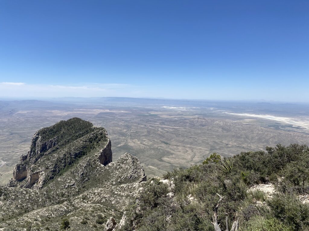
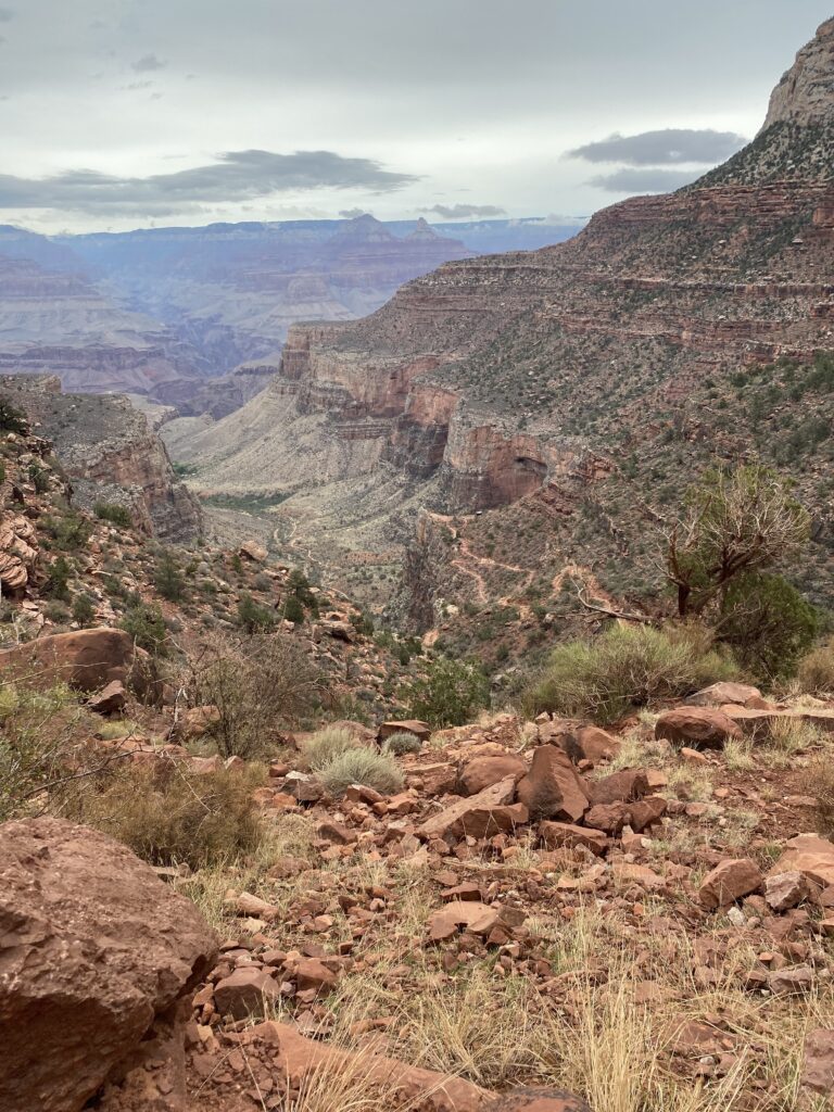
The following day I drove from Flagstaff to the south rim of the Grand Canyon. The federal shut-down was in full swing. I showed the ranger at the entrance gate my America the Beautiful card, and she waved me through. I picked up a map, though, and found a parking lot close to the Bright Angel trailhead. This was my second trip to GC, although the first one was a short traipse along the south rim in February. Snow littered the ground, and we stuck close to the visitor center that day.

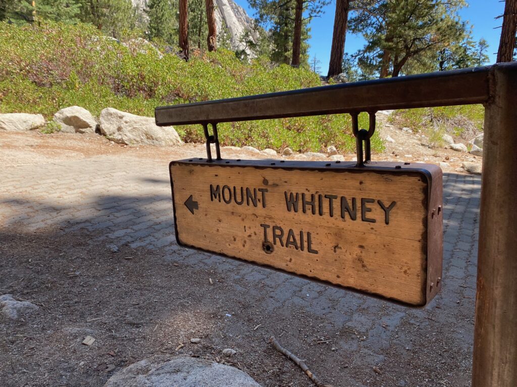
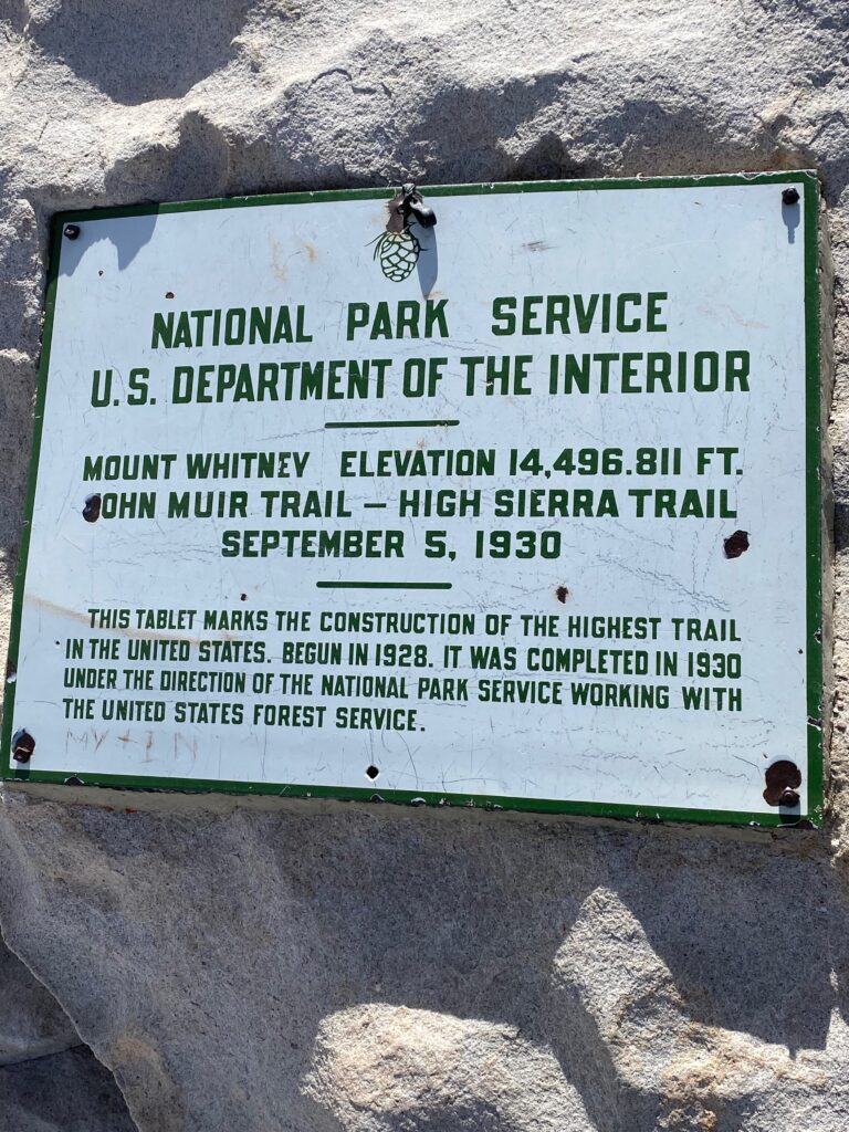
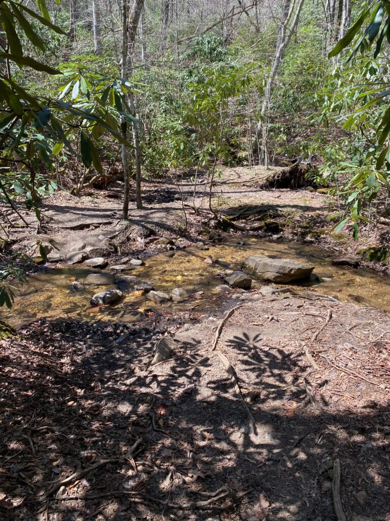
Not today. Loaded up with water and food, albeit with a late start of 9:45am, the trail down Bright Angel beckoned. I figured on a trip of around two hours down, and three hours up, enough time to make it back to the car in order to get on the road and reach the next hotel before dark. Having hiked Mount Whitney two months prior, and many other hikes where you go up first, and then return down, hiking Grand Canyon is a different experience. The switchbacks aren’t too bad. Passed many hikers going only a mile and a half, or three miles. Still heading down. Then, near the fifth mile you reach Havasupai Gardens, a lush a watery respite from the desert and constant downhill. Several people were there, resting or just hanging out. Went past the gardens another half mile, into a canyon with steep walls on one side and a creek on the other. Really wanted to keep going to the river, but turned around at noon.

The trail uphill isn’t too bad, until you get to the last mile. Then you start to feel the elevation and the fatigue in the legs. Still, made it out in good time, and on the road again. Drove down a canyon on the way to and through Sedona. Might have been the best part of the trip, aside from the Bright Angel hike. Past Sedona and into another small town. Checked into the hotel, and drove to dinner. Lots of rain, which I didn’t expect. That week there were lots of floods in that part of Arizona, all the way down to Phoenix.

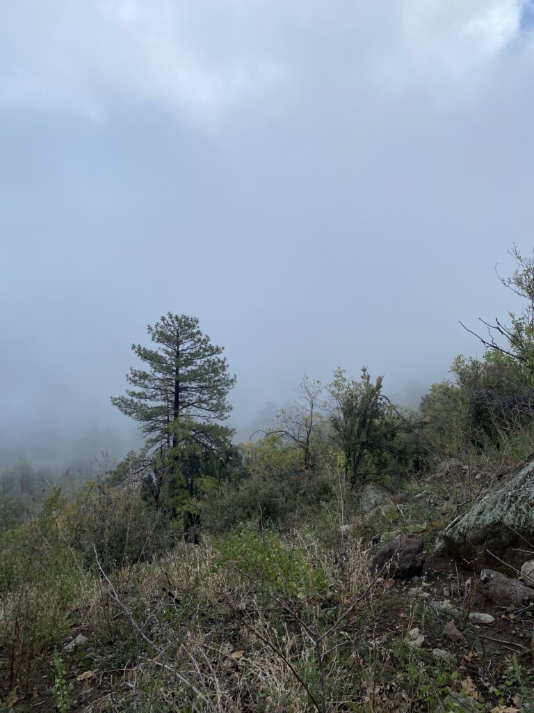
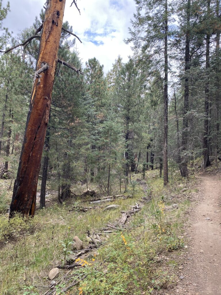
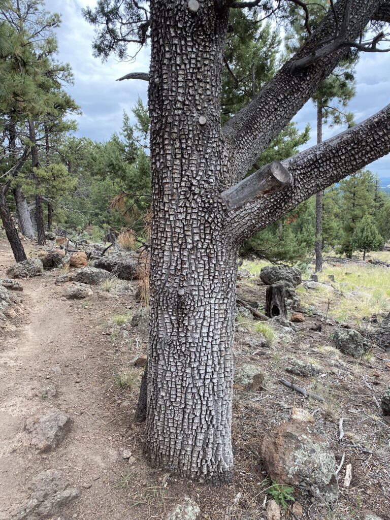
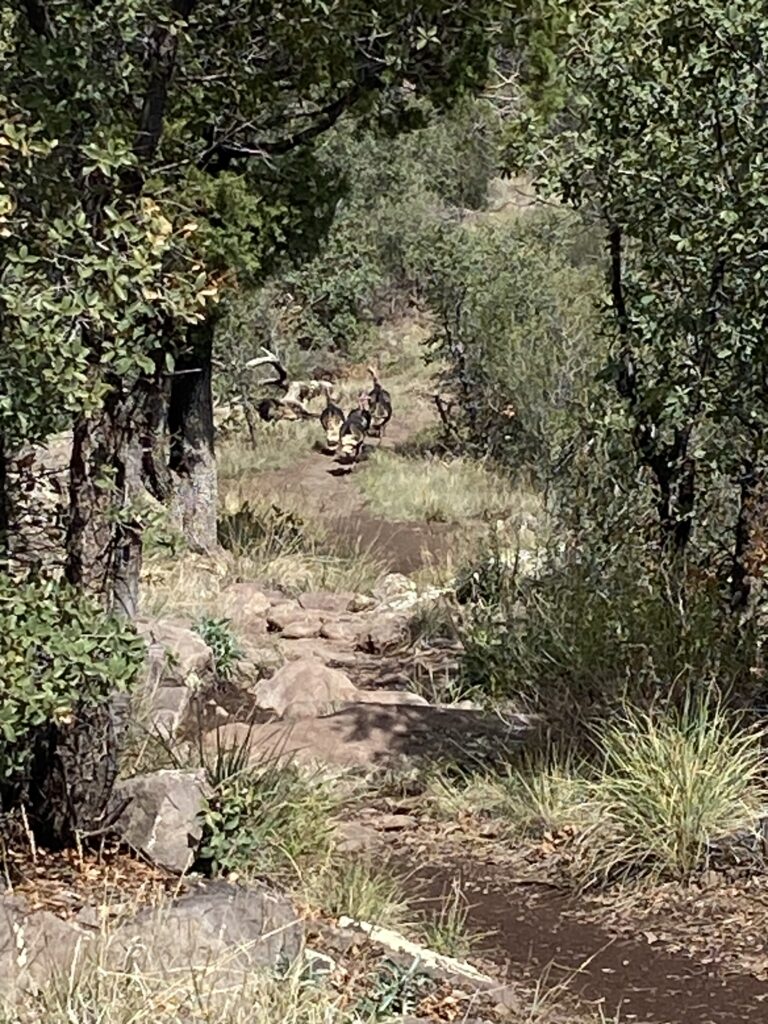
The next day, drove up into the mountains, past the town of Jerome, which is perched on the side of the mountain. Another place I’d like to explore or visit. This time had to keep going. A few miles later, pulled into a recreational area. A short hike in Mingus Mountain, where a group of turkeys trotted ahead. I didn’t make it all the way to the end of this trail, as rain clouds threatened. Still, a neat experience.

On the way back, fog rolled in. I’d already driven partially in the clouds, but now it seemed more real being above the clouds. In Flagstaff I bought a book on hikes in northern Arizona. This book left out the Grand Canyon, as there are plenty of other trails in this place. One could spend many, many days trying to hike all those trails. What an awesome place. Nothing like the area south of Phoenix. Nothing like the area around Phoenix. Then again, I’ve not seen much to the west of Phoenix, so maybe there’s more to the state than the northern part.

Hiking Mt. Whitney in one day

Not even halfway up the trail to Mount Whitney, disaster struck. Shouldering my Gregory Zulu 30 backpack after a short break, the sternum strap snapped, sending two pieces flying into the night. In the darkness I managed to find both pieces, but there was nothing I could do except pocket them. For the rest of the hike I would be forced to occasionally grip my shoulder straps or continually adjust them, as they constantly cut into my shoulders. At least this effort took my mind off the endless switchbacks.

We’d started our hike, as planned, around 10pm Sunday night. Along the trail we’d met a few people heading downhill. The two or three people who were friendly enough to chat said they’d summited around 2pm that day. They’d then made the perilous descent from Trail Camp in the dark, while we would do the reverse. They trudged in silence past us, maybe too tired to care at that point. At 11:30 we reached the Whitney Zone sign. There, we sat for half hour in the quiet dark waiting for our moment.

At a few seconds after midnight, we stepped into the Whitney Zone. The first mile or so to Outpost Camp and slightly beyond is an easy hike. A short distance past Outpost Camp we crossed a creek, where we met a solitary figure on the other side. It was nearly 1am at this point. The lone figure, a man, asked if this was the path to the trailhead, and we assured him that he was only four miles away. He sighed, gestured at his feet, and said that with his sore feet he hoped he’d be able to make it. We wished him good luck. Our path took us onward, and from here it was almost all uphill.

In the darkness we made our winding way up, up, up, for what seemed like the entire night. We took several breaks, including one where my sternum strap met its sad fate. For a long time it seemed that we were the only people on the trail. At last, we reached Trail Camp. It was still dark, and we tried to not make too much noise as we walked past the tents. At the far end of camp we encountered two groups of hikers as they emerged from their campsites. Together we started the infamous 99 switchbacks, and then spent the next hour plus leapfrogging each other. At the sun struck the horizon to the east, we arrived at Trail Crest, a pass that lay around 13,000 feet above sea level. Here we paused for a longer break, then walked down to the intersection to the John Muir Trail. Past this intersection stood a sign warning people of lightning danger. As it was around 6:30am, we didn’t think this would be an issue for us. From here, however, the summit is still nearly two miles away, and pur pace would slow.

Those next two miles were almost the toughest miles of the trip. The trail hugged the mountain side. Occasionally we scrambled ove boulders, where one wrong step would send you plummeting many hundreds of feet below. We passed a couple of windows between more solid paths, then walked along some dagger-like smaller peaks. At last, we were on Whitney proper. The summit at this point still seemed distant. We crossed a small ice-field; no need for micro-spikes here. Then, it was a matter of surviving the final push. We took many breaks the last half-mile, then finally reached the Smithsonian hut at the summit. Here we rested for a while, before making our way back.

Getting to Trail Crest from the summit was still tough, but the 99 switchbacks in daylight was nothing short of torture. The sun at this point was out, and no shade was to had for many miles. We staggered back and forth along endless 180 turns. As we made our way down toward Mirror Lake, we thought we were on the wrong trail. I kept checking my GPS, which showed us on trail, and we even stopped and asked people if it was the right trail. We’d walked up here in the dark, so nothing looked familiar. I can only imagine how the hikers who walked through this part of the trail at night must have felt. Did they go off trail? Some people have fallen here, several have died. So close to the end, and yet such a lethal place. Here we saw our first and only marmot, a curious little fellow.

We walked through Outpost Camp, crossing creeks and dusty plains. Then, more switchbacks, and finally exited the Whitney Zone. No one asked for our permit, which was somewhat disappointing. The last three miles from Lone Pine Lake to the trailhead took forever; we finally reached the trailhead at 3pm. We’d been awake for close to 40 hours at this point, and headed back to our car and Lone Pine consumed only by thoughts of food and sleep.

Hiking Mount Whitney in one day is no joke. I’m glad we started at night, especially in the Summer. Afternoon thunderstorms would mean that people summiting past noon would be exposed to lightning, rain, hail, and also would have to hike from Trail Camp to the trailhead in the dark. To me that doesn’t sound like fun, especially when tired. I’ll never do the trip in a single day again. That said, if I were to hike Mount Whitney again, I would plan a multi-day trip from Horseshoe Meadows instead. Take three or four days, enjoy the lakes and meadows, even though it would mean going down the endless switchbacks again.

Now, if only there was an easy way to slide the replacement sternum strap back on my backpack…

Lone Pine Lake hike

This was our second acclimation hike prior to attempting Mount Whitney, and our introduction to the trail toward the summit. The first three miles of the trail are open to the public. But, shortly thereafter you cross into the Whitney Zone, where you need a permit. We had secured a permit for August 5th, and so two days prior we hiked up the trail to Lone Pine Lake, just outside the Whitney Zone. To get to the trailhead from Long Pine, you drive ca. 30 minutes up a winding road into the mountains. Our GPS decided we needed a tour of the camp site first, and so we ended up slowly winding our way through that location before continuing upward. There was no parking near the trailhead, as we arrived in the middle of the day on a Saturday. We ended up parking as the second to last car in a long line of cars along the road, roughly a quarter of a mile from the trailhead.

We walked up the road, then found the trailhead. This was our initiation to the many switchbacks up the Whitney trail. It was a warm day, middle of summer, and the sun beat down on us. Along the trail we encountered a large group of backpackers, possible heading to Trail Camp with plans to summit the following day, possibly starting along the John Muir Trail from Whitney. We forgot to ask, even as we leapfrogged each other a few times. We did pause to ask a couple heading downhill about the ideal time to start, and they suggested 10pm, which would let us cross into the Zone around midnight. That became our plan.

Ahead of us towered the mountains. The path was dusty, with three creek crossings, each wider than the last. After a mile or so, we passed a side trail going straight up a hill, which takes you to the Mountaineering Route to Mount Whitney. Few people probably use this trail during the summer. The most interesting feature for hikers might be the log crossing, where multiple flat logs lead you across a wide creek. Some of the logs need to be replaced, but we made it across. Shortly afterward we came to the intersection leading to either the Whitney Zone or Lone Pine Lake. We turned left and walked downhill to the lake.

Several people were hanging out by the lake. Some actually went swimming in the water, and a couple tried their hand at fishing. I think they gave up quite quickly, and went back to lounging by the water’s edge. After a short break for lunch, we headed back up the short hill, then down the trail again. With less than a mile left, we met a person heading uphill who asked us if we’d seen a cell phone. We had not, and continued to the trailhead. After a break near the store to drink a well-deserved cold soda, we headed back to the car. Not far from where we’d sat drinking out sodas, we saw the same person again. He and his wife asked if we could give them a lift to Lone Pine. They’d just finished the John Muir Trail from the north, covering the distance in 19 days. We said sure, and dropped them off in town, where I think they were planning to celebrate their journey with friends, and possibly some bottles of wine.

At this point we still felt confident about the Whitney hike. We’d be returning the next day, but around 10pm, when it would be pitch black, to begin the actual hike to the summit. We’d covered the three miles to near the Whitney Zone with no issues, so we figured it would take us maybe an hour and half the following day. Now it was time to rest, and maybe get a pizza to celebrate stepping onto the Whitney Trail.

Cottonwood Lakes Hike

In preparation for a Mount Whitney hike, my son and I hiked from Horseshoe Meadows to Cottonwood Lakes #4 and 5. As an out and back trip, this was close to 13 miles, with around a thousand feet of elevation gain. This doesn’t sound like much, but the trailhead was already at 10,000 or so feet above sea level.

Starting from Lone Pine, the nearest town, most of the elevation gain up to that 10,000 foot level was done via car. From Highway 395, we drove down narrow roads until we began the ascent. The road winds up multiple switchbacks, many of them visible from the highway. After around 40 minutes of driving we reached the campground. Here we found a single parking spot open. There were multiple signs about bear activity. Many of the campsites were taken, but this is also a staging area for people hiking northbound along the John Muir Trail to Mount Whitney (or beyond, though I suspect many hikers on that trail get a shuttle from Lone Pine).

The terrain is mostly flat for the first couple of miles. There are trees, and the ground is dusty, gray. In early August the temperature was already in the 80s F, with almost no cloud cover that day. We started our hike around noon, after getting our Whitney Permit signed and looking around the visitor center (as well as dealing with a battery issue on the nearly brand new rental car). Along the way we passed many people returning from caping or hiking. We also ran into a group that was planning to hike the New Army Pass and then onward to Whitney. They planned to summit the same day as our Whitney Permit, and we left them with a “see you at the top” hail, being then full of confidence.

Slightly after two miles, the ascent begins. It’s only a short one, and we reached the top after a few short breaks, all cut short due to mosquitos. Along the way we marveled at the many meadows and wonderful scenery. Yes, it’s rocky and dusty, but the Eastern Sierras are a marvel to behold. The trail is well-marked and appears quite popular.

At the top of the climb, the trail is fairly flat. We passed the first couple of Cottonwood Lakes, then saw the wonder of Cottonwood Lake #3, the largest of the five such named lakes. At the far end there’s a small waterfall. Near the trail as it approached the lake, we founded a shaded spot and rested for lunch. We saw several people walking back from the lake, or continuing along the trail beyond the waterfall.

After our break we walked over to the waterfall, then walked up a short distance to the final two lakes. The Old Army Pass trail lies between lakes #4 and 5. We stood there and saw no trail, so we wondered how anyone would make it up that pass. On the way back, we did speak to someone who planned to camp near those two lakes and go up the Old Army Pass, so I guess it’s still possible.

Going downhill is so much better, and we quickly passed groups of people that we’d seen leaving half an hour or more before our walk to the last two lakes. We reached the trailhead in daylight, but figured some of the people that we’d passed likely would arrive there after dark, based on their pace. For our first day at altitude, this seemed like a great hike. Mount Whitney lay three days in the future, and as we drove back down the switchbacks we thought it would be just as easy as Cottonwood Lakes. Reality would prove different.

Guadalupe Peak Hike

On the morning of July 4, I headed west from San Antonio with my 19-year old son. We drove along Interstate 10 toward Fort Stockton. This was a four hour drive from San Antonio. Once in Fort Stockton we’d turn northward, with Carlsbad, New Mexico as the goal for the day. Leaving Texas, even from somewhere in the middle, does take an entire day of driving.

Along the way we passed Kerrville, and here we encountered pounding rain. At that time we had no idea of the tragedy unfolding along the Guadalupe River between Hunt and Comfort. I’ve driven along that river countless times since 1989. Both my kids have camped near Ingram, which is between Hunt and Kerrville. There are numerous low water crossings there, and I have only seen the Guadalupe River as a quiet stream while along the road next to the river. Only later would we learn the scope of the flooding, and all the lost lives, including dozens of young girls from Camp Mystic. A couple of hours after we passed Kerrville, in Ozona, we switched drivers. Here I checked the news, and saw the unimaginable headlines: young campers missing, vacationers missing, residents missing. Massive flooding beyond the 100 year event. The news was almost too horrible to imagine. Since then I’ve learned that families in my neighborhood have been affected, have lost people.

We took a break in Fort Stockton for lunch, then headed up the slow road northward, somewhat subdued. Speed limits in New Mexico are different from those in Texas, so it took time to get to Carlsbad. We arrived at our hotel just past 4pm, checked in, and rested. When we went out for dinner, we thought we’d have many options. However, as it was July 4th, most places were closed. After a long wait at one of the few open restaurants, we ate our late dinner.

The next morning we were up early and drove the hour south to Guadalupe Peak National Park. We arrived 15 minutes before the park offices opened, and were first in line outside their doors. Two surly park employees sat behind the counter. I paid the entrance fee, but as the person helping me said nothing; I matched her, asking only about a park pass. I overheard the other employee advising someone to carry lots of water, mentioning multiple rescues as if it was an imposition. Meanwhile, the person who helped us said nothing. Either we looked like we knew what we were doing, or she didn’t care. Back at the car, we drove to the trailhead, grabbed our gear, and headed to the trailhead. Then again, we had prepared for the environment, brought lots of water, and had serious hiking experience. I guess we did know what we were doing.

There are many trails in Guadalupe Peak National Park. Our goal today was the summit, at 8,751 feet above sea level, and about 3,000 in elevation gain. Supposedly everything’s bigger in Texas, though Colorado and California have those altitudes beat by at least 6,000 feet in elevation, and Colorado has dozens of peaks over 14,000 in elevation, easily beating Texas.

A sign inside the park office warned people that the first two miles were the hardest. They were off by around half a mile. We took our time going up those two and half miles, stopping at regular intervals for water breaks. Even after two miles the views were breathtaking. Along the trail, we grumbled as we headed upward, as it had been some years since our last mountain hikes.

After those first two hard miles, the trail evened out slightly. The terrain changed, and we saw trees and meadows. With around a mile and half to go, there’s a side trail toward a wilderness camping area. We took that side trail, as I wanted to check out that site; years ago I’d thought about an overnight hike here, but went with Big Bend instead. At the camping site we took a short break, then returned to the main trail. We thought we saw the peak from that vantage point, but it was still a thousand feet of gain from there. The trail then crossed a bridge, which seemed out of place on such a trail. This bridge spanned a section where a rockslide appeared to have broken the path. Shortly after this, the last half mile turned into a scramble uphill. This was one of two places where signs warned people to dismount and lead pack animals, which confounded me. How could any mules or horses handle the trail, I thought? Still, it happens.

At last we reached the peak, exhausted and hungry. Since it was the peak of Summer (no pun intended), it was fairly warm throughout the hike. The peak was noticeably cooler, though still exposed. We found a shaded area, where we ate some food and rested. There we saw a snake a few feet from where we sat, though we didn’t think it was venomous. It was exactly noon when we reached the top, and several people sat on rocks around the peak. Some of them took selfies and other photos, posing as if they were models. Thankfully there was no wind or clouds. The Guadalupe Peak area is known for strong winds in the Fall through Winter, and sometimes there’s flooding.

It had taken us three hours to reach the top, though this included many breaks for water. Going down took only two hours, even with occasional breaks. The park notice stated that a round trip usually takes 6-8 hours. Our total moving time was just over three hours, but then we were consistently taking breaks to drink water, given the heat, dry air, and elevation.

Guadalupe Peak is a popular hike. We met several hikers on our the way up. Maybe they had camped and started earlier than us. We also saw a couple of hikers heading up as we descended. Some hikers didn’t seem prepared for the terrain or weather; people in sandals, not carrying any water, seemed out of place. When we’d checked in at the office, I overheard one of the rangers saying that on average they had to rescue people three times a week. Although few people have died on this mountain, it’s a fairly easy trail. I’d rate it around 4 out 10, but then I’ve hiked in many places. We met some people who probably thought it closer to 8 out 10, but also saw young children on the trail. Weather is critical, so if you plan to hike this trail, be aware of winds and temperatures.

I’ve now hiked both Big Bend National Park and Guadalupe Peak National Park, both in far West Texas. This is desert country, although there’s elevation and mountains mixed into the landscape. I do need to see more of East Texas, but from what I know of that area there are swamps, alligators, and snakes there, so maybe I’ll pass. I’d like to hike some of the other trails in Guadalupe Peak National Park, but some of them require camping and better planning, or better timing. And, it’s a hell of a long drive to get there from here. If you’re ever in that area, it’s well worth a visit. Planning’s important, though. Don’t get caught without water. Wear proper shoes. Start early. Pay attention to wind and temperature. Check the weather forecast.

Enchanted Rock Hike

Enchanted Rock is a strange geological phenomenon outside Fredericksburg, Texas. As a State Park, it’s a heavily visited place, as it’s close to the cities between San Antonio and Austin. Since 1988, when I first arrived in Texas, I’ve visited this park several times, and passed through or visited Fredericksburg even more times than I can count.

However, the last time I climbed the Rock was close to 17 years ago, when I took my brother there. He was visiting from Norway. We rented a house in Fredericksburg in winter and climbed up the Rock on a windy winter day. On the way back to San Antonio we did some wine tasting, and fortunately had someone else as a driver.

Credit Texas State Parks

The hike to the summit is almost straight up. There is no trail once you get on the rocky surface. The views from the top as you look over the Hill Country are spectacular. It was a cloudy day when I was there, which at the end of April meant it wasn’t too hot.

This time, I went by myself, and decided to mix in some hiking around the park. All the other times that I’ve been there I’ve only gone up the Rock, as I’ve been with small kids or non-hikers. On weekends, it’s a popular destination, so I had to make a reservation online. The trip takes around an hour and a half from my house. The last 20 miles are on a narrow winding road, and soon I was part of a convoy stuck behind a nervous driver. My reservation was for an entry at 10:30am, and I planned my trip almost to the minute. I arrived at the park entrance at 10:28am. The ranger on duty took my reservation printout, marked something on it and returned it along with a map. I parked at the first available spot, which wasn’t the smartest thing. I’d planned on hiking the Loop Trail, which wound around the outside of the Rock for about five miles. The start of the trail was not close to where I parked, so I had to walk on the park road a bit to get to the trail. Never having attempted any hiking in the park, I simply went for the first open spot.

The park has several campsites near the entrance, as well as primitive sites around a mile or two away from the main parking areas. I’ve tried to book some of those sites in the Fall, but without luck. You have to book them far in advance during the cooler months, and I tended to wait until it was too late. I carried a pack with water, snacks, and some emergency gear, just in case. Water’s important in the Texas heat.

For the Loop Trail I went clock-wise, starting at what could be considered the nine-o’clock mark. The trail itself is well marked, wide, and mostly made of grushed gravel. There are places here and there where heavy rains have carved a deeper path, but for the most part it’s an easy walk. At one point, the trail diverged. I took the path that went past the Walnut Springs primitive camp sites, as the map indicated it would hook up with the main trail again. In the first few spots of that primitive camping area I saw some tents, but also many open spots. At the end of the camp site area the trail narrowed to a single track path. I was all alone here, and walked in silence. Aside from some lizards and buzzards I saw nothing on this spur. The trail rejoined the Loop trail near Moss Lake campsites. I didn’t see the lake itself, and went on, meeting some other hikers along the way.

As the trail neared the main area of the park, it narrowed to a single track again. I passed some hikers, several who had dogs on leashes. Here the path was rocky, and you had to watch your step. At the end of the Loop trail I paused for a snack, then shouldered my pack again and headed for the Summit Trail.

There were many more hikers on the Summit Trail, as anyone who comes to Enchanted Rock comes here to climb the Rock. It’s just under a mile from parking lot to summit. The rock is bare, pockmarked with holes of varying sizes. Some of these contained water. At times there was some vegetation, but as a photo shows it’s mostly a big rock. What you don’t see is on the other side, where slabs of the rock have fractured and slid down, or are in the process of sliding down. The Rock is slowly disintegrating. I turned and headed back down, then drove into Fredericksburg, where I had a beer and Wienerschnitzel at a biergarten. I walked along main street first, which is mainly shops now, with few places to eat. How the place has changed. Then I left town, passing winery after winery. It’s no longer the place I remember, but at least the Rock is there still.

Just remember, if you plan to visit on the weekend, make your reservation first.

Lost Maples, at last

Lost Maples State Natural Area is a state park in Central Texas. In the Fall, people flock here to see the changing colors of the maple trees; maple trees in Texas is a rarity, apparently .

I’ve tried a couple of times to reserve a trip here in November, with no luck. That’s the time the colors change, but I’ve not been able to secure a day pass or a camping pass then. So, on the spur of the moment, I drove two hours from San Antonio to this location in mid-April, to see the park in Spring, instead of in the Fall. Why not, I thought, as it’s still “relatively” cool for Texas.

The first question from the range ranger in the check in HQ when I arrived was, “Do you have a reservation?” I did not, but apparently it was not a busy time, and so I was allowed in the park and do a day trip. I am not sure if Monkey Rock looks like a monkey. Go figure. Maybe it’s the angle.

There are two main trails—East Trail and West Trail. At some point along the West Trail, there is a 2.5 mile loop called the West Loop (more like a lollipop trail), to add more miles or find primitive camping spots. I parked my car near the East Trail trailhead at around 10am. The temps were already at 70 F. I switched into hiking boots, strapped on my daypack, and started up the trail. I encountered only a few people here, some who had camped the night prior, some who were day hiking, or heading to a campsite.

The East Trail starts easy, then hits a steep uphill ascent after about a mile. Switchbacks are unknown in this park, and the trail to the top goes almost straight up for half a mile. Once at the top, there’s a nice easy walk along the ridge. I saw a Boy Scouts troop (can we still say that, these days?) taking a break at an overlook. Were they training for Philmont? I didn’t ask.

The descent was rocky. I paused at one point as a snake crossed my path. I don’t think it was venomous, but I didn’t ask it. I didn’t see any rattlers, and the snake didn’t pause to warn me. The path from the East Trail connects near a pond to the West Trail, so I switched to that trail, and headed west. At one point, there is a sign to the West Loop. I figured, “why not?” and took that path. After half a mile or so, another uphill. I met a few hikers, and returned to the West Trail. Then, alone, I took this trail back to the start. Only, it wasn’t the start. There are two parking lots, and I stopped at the wrong one first. I turned around and found the trail back to my parking lot, and so, almost 10 miles (but not quite) of hiking later I completed almost all the trails in this park; since I took the West Loop I missed one section, but it was a separate return to the trailhead and I wanted a longer hike.

Along the way, the temperatures surged into the 90s (F). I bought lots of water, enough snacks, and so the hike wasn’t too bad. How is this in the Fall? I don’t know. In the summer months, I would skip this hike. Much of it is under trees, but there are sections in the sun. In the sun in the summer you’ll see temps above 100F, and that’s no fun at all.

The drive from my house took two hours, with one stretch slowed to a crawl by two motorcycles too cautious to drive above 45 mph in a 65 mph zone (not to mention a delay caused by construction). Once behind the motorcycles, the routes curved, rose up and down, and for nearly 20 miles there was no way to pass these idiots. Finally, one tiny straight section appeared, and I took it. On the way back, some sports cars had no issue passing me while I was going 65. If they had to deal with those motorcyclists I’m sure they would have tried to pass them around a bend. In my case, I was at 65 and not 40, but I guess that didn’t matter here.

And so, I think I’ve visited almost all state parked near where I live. Now I have to expand that radius. In Texas, two hours is a short trip, I guess.

Day four on the Appalachian Trail

Blood Mountain is not a bad climb going north-bound. The descent, however, is the nightmare part of the trail.

I awoke early, around 7am, feeling somewhat refreshed. I can’t say that I slept well, as I tossed and turned all night, which is usual while camping. I broke camp quickly, stuffing all the items into the backpack rather than folding them neatly as before; I would later repack properly at the hotel. I collected my bear canister, which appeared untouched. My attempt at breakfast failed, as I could not hold down even small amounts of food. I figured that with less than four miles to hike, I could make it with just water, as solid food that day didn’t seem to work. The other campers nearby were quiet, so I tried to pack up my gear quietly as well.

The final hike up Blood Mountain proved fairly easy, and I reached the stone shelter at the top in short notice. I didn’t stop there, but as I walked passed the shelter I saw the female hiker who’d passed me right before Springer. She was packing up her gear, and didn’t see or didn’t notice me as I walked passed the shelter. At this point, anyway, I was still tired and didn’t feel particularly sociable.

The view at top of Blood Mountain was obscured by trees. There were gaps here and there, but I didn’t pause or walk around the site. Instead, I followed the white blazes on rocks and trees, and eventually these led me downward. I crossed expanses of rock, paused now and then to find the trail, and then it became a matter of bouldering downhill. At times the trail became less rocky, but the descent was for the most part tricky, rife with rocks and roots, and it took me longer than I expected. At one point, where the AT intersected with some other trail, I had to pause and search for a white blaze. Shortly after that confusing moment, I encountered a trail runner. I was surprised, as he was older than myself. He mentioned that he’d just cut through a large fallen tree. We talked for a while about the trail, and how it was poorly marked. He lived nearby, and volunteered regularly to check the trail. I bid him farewell, and continued downhill.

Eventually I saw a road, and then a sign announcing the other side of the Blood Mountain Wilderness. Neel Gap lay ahead. I’ve head people refer to it as Neel’s Gap, as well as Neel Gap. A tarmac road intersects the gap, just like Woody Gap. On the other side is Mountain’s Crossing, a store that stocks food camping items. They also have a hostel. Apparently 25% of thru-hikers quit here.

I crossed the road, reaching the tree where many thru-hikers give up and toss their boots and shoes. As a section hiker, and having only brought one pair of shoes, I kept my shoes on my feet. I ascended some stairs, then I dropped my pack outside the building and walked inside. The place looked like a mix of a mini-REI and a tourist trap. There were t-shirts, hoodies, gee-gaws, food, shoes, and other camping gear. I bought two Cokes, took them outside and gulped down the first one. It was 9:30 in the morning, and I was exhausted. I drank the other Coke more slowly, then walked around the store once more. I bought some magnets for my wife, went outside. Someone offered me slice of pizza, but I didn’t think I could eat anything. However, after a while I reconsidered, and realized that I needed to eat something. I bought a small packet of chips and a Sprite. Shortly after consuming both, I threw up, which was far from my proudest moment.

I walked around the building, trying to get back to normal. I placed my slightly used gas canister in the hiker box, along with a lighter. Maybe someone would benefit from those items. Eventually, the thru-hikers who’d camped at Lance Creek showed up, one by one. I greeted the ones I knew. Then, two of the women I’d met at Springer showed up. The other two in their party had quit at Woody Gap and had returned to their starting point in Helen, Georgia. The two remaining hikers planned to continue onward to Unicoi Gap. They’d also been the ones that I’d heard arriving near my campsite at the base of Blood Mountain. Props to them for continuing. They were from Florida, a place as flat as my own home base, or maybe flatter, and had hiked relentlessly up and down each mountain.

At Neel Gap I contacted my shuttle. When I first booked the shuttle, I’d asked them to pick me up at 1pm, as I thought I would camp at Woods Hole Gap, and also that it would take me a while to hike up Blood Mountain. They were dropping off another hiker around 11am, so could get me two hours earlier than planned. I hung around Mountain’s Crossing, and thought about all the ups and downs of the trail, how I had failed to embrace the suck, and how guilty I felt for complaining along the trail. Shortly after 11am, the shuttle driver arrived. It tool an hour to drive back to Amicalola Falls State Park. My car was covered in detritus from the trees. I drove back to the visitor center, dropped off my parking pass, and headed toward the conference on Lanier Lake.

Along the way, overcome by hunger, I pulled into a strip-mall, where I found a pizza place. I ordered more than I could eat, took the rest with me, and got back on the road. At the conference center, I spread my camping gear over one bed. Over the course of a few days I slowly organized the gear into my backpack for the return flight.

Would I change anything? Yes. I should have taken longer breaks, and worked more on my food intake. I now know that the Appalachian Trail involves a lot of ups and downs. And I mean a lot. Every “gap” listed on the map means an up and down, or a down and up. This is something that reading blog, books, etc. will not teach you. Watching videos on YouTube is no substitute for the real thing. There is a lot of climbing. At least I was lucky with the weather, as it never rained nor snowed while I was on the trail. It was hot, however, which I didn’t expect for this time of year.

Will I go back? I hope so. I really want to complete Georgia. I want to hike the northern part of Virginia. When? I have no idea. Maybe in 2026, as I tend to plan out things a year or two in advance, and 2025 already has specific goals. Will I complete the entire trail? It’s 2,100 miles or more. Hiking 40 mile sections at a time will not get me there, not with the years that I have left. So, I highly doubt that I will even hike a quarter of the distance. That doesn’t bother me. The trail crosses 14 states. I might walk three or maybe four of the states. So be it.

If you hike the Appalachian Trail, either as a day hiker, a section hiker, or a thru hiker, take a moment to marvel that this trail exists. To anyone who walks the AT, where it’s a mile or the entire distance, take many moments to pause at the fact that this trail exists. I count myself lucky to have been there, even I walked less than 2% of the trail.

Day three on the Appalachian Trail

I awoke early, packed up, and was on the trail before the trio of thru-hikers broke camp. They were all young, maybe mid-thirties, and highly motivated, so I figured they would pass me at some point during the day. Today’s goal was Woods Hole Shelter, at the foot of Blood Mountain, just over 12 miles from Gooch Gap Shelter. It would prove a tougher day than the one before, but also a highly rewarding and emotional day.

I rejoined the AT trail in good spirits, and although the trail still went up and down, for a long while it actually followed a contour line along a mountain. I stopped at a clearing with a great view, chatted with another hiker, and we took each other’s photos with the view as a background. Familiar hikers passed me. I passed some of them. There’s a section on Blood Mountain where bear canisters are required. A quartet of thru-hikers (three from Gooch Gap Shelter and one other) planned to camp just outside the bear canister zone, at a campsite called Lance Creek. They worried that the limited number of tent sites would fill up, and considered options slightly beyond that area. I carried a bear canister, so I didn’t worry about locations.

Slightly before the halfway point, I encountered the thru-hiker who wasn’t keen on close neighbors. He mentioned a rumor of trail magic ahead on the trail. At this point I had started to flag, and in a moment of despair told him that I expected all trail magic gone by the time I arrived. I think I expected a single cooler with soda cans, nothing more. Instead, as I reached Woody Gap, a location with a paved road intersecting the trail, I saw a professional-looking sign announcing trail magic ahead.

It turned out that a pair of older women who had hiked the trail years ago each year drove down from Indiana (I think, as I can’t exactly remember their home state). They handed out hot dogs, chips, cookies, other snacks, and sodas. I was briefly overcome with emotion as I thanked them. All other hikers who reach that site thanked them and asked if they could donate money, but were refused. I ate my hot dog, a bag of chips, and drank my soda. Nothing tasted as great as that brief meal.

After lingering there an hour or so, I lifted up my pack and entered the Blood Mountain Wilderness. My goal the for day lay just over five miles away. I would prove a difficult five miles. Much of it was uphill. The heat pressed down on me. Twice I reached a creek, where I rested and poured liters of water on my head. One of the thru-hikers headed for Lance Creek passed me, as did two others.

Eventually, I reached Lance Creek, where I saw three hikers had sent up tents. I waved to them and told them I was continuing onward, as it was early afternoon. When I reached the plateau right before the last climb up Blood Mountain, I saw the sign for Woods Hole Shelter. It lay 0.4 miles downhill, away from the trail. I grimaced, then started down the trail. After around a tenth of a mile or so, I stopped. I really didn’t want to walk 0.4 extra miles each way, especially uphill the next morning. I consulted my map and saw there was a campsite up the hill. Returning to the plateau, I dropped my pack and rested for a while (a euphemism for collapsing on the ground and resting my head on the pack). Another hiker arrived, and asked about the shelter. I pointed down the hill, warning him it would be a bit of walk. He decided that was not an issue, and departed down the hill. After a while, I picked up my back, tossed out a few curses, and continued up Blood Mountain.

Shortly thereafter, I reached a creek, where I once more poured several liters of cold water on my head. Feeling invigorated, I started my ascent up the steep hill. To my surprise, only a short distance away I found the listed campsite. I dropped my pack, and made an inventory of my water. Two of the water bottles were empty. I had around four miles to hike the next day, and for the sake of hydration insurance I took those empty bottles down the hill and filled them up at the creek. Back at the campsite I put up my tent, taking many breaks. I tried to eat something, but my stomach at this point couldn’t handle any food. Two hours of sunlight remained, and that light pointed directly at my tent. I gathered up all smellables—food, toothpaste, sunscreen, etc—into the bear canister and wedged it between some branches up the hill, then crawled into my tent and tried to rest.

At some point during the evening I heard a coyote, then some female voices. Other hikers had found the same camping area. Each tent pad in that campsite was far enough away that I never saw them, but I heard them for a while talking and then greeting another late arriving hiker. My goal at this point was just to get some sleep. A couple of hikers that I’d encountered a mile or so before the start of the true ascent of Blood Mountain said it wasn’t a bad climb on fresh legs, so I thought that a night’s rest would help. It turned out that was true, at least for the climb. My fourth day consisted of less than four miles of hiking, so I knew it wouldn’t be another long day. I also had a deadline of 1pm, when my shuttle would arrive to take me back to my car. I worried about the uphill, but it was the downhill that would prove the hardest part of the day.

To be continued…

Day two on the Appalachian Trail

After the “approach trail,” which apparently not all thru-hikers take, I went another three or so miles to Stover Creek Shelter. My total distance hiked for the first day was ca. 12 miles. At Stover Creek, I set up my tent, then made my major mistake of the hike, one I would repeat one more time: I failed to eat dinner. Instead, I crawled into my tent around 6pm and just tried to sleep, despite sundown still two hours away. Even though I wasn’t tired, I felt that I needed the rest, and also I didn’t feel hungry enough to heat a freeze-dried meal. Nor did I think of a snack at this point.

One of the things I learned in my over 500 miles of hiking along various trails is that consistently I fail to properly fuel while hiking. I lose my appetite somewhere along the trail, and I struggle to eat solid foods, either power bars nor rehydrated food. I eat sparingly, and pay the price near the end of the day. This is far from ideal, as hiking multiple miles in one day meals that calories are burned, and the body needs to be replenished. I probably also do not drink enough water, although I made an effort on this trail. I carrier three liters of water, and refilled my water bottles often along the way, using both a filter and purifying tablets. The days were hot, and I made myself drink fairly often as I walked. Still, I probably didn’t drink enough.

First day, not so bad, I thought. I camped where I planned to camp. The next day, I planned to hike to Gooch Gap Shelter, another 12 or so miles from the Stover Creek Shelter. I woke up early, packed up my tent and gear, ate a breakfast bar, and set out on the trail around 8am. At first, I took it slow, enjoying the green tunnel and silence, until I was passed by another hiker. Then I re-evaluated my pace and went from a stroll to something faster. Another mistake. Hike your own pace is the key. However, from now on I measured myself against this hiker’s pace, as we would leapfrog each other time and time again in my days on the trail. This shadow of mine was a thru-hiker, around twenty years younger, and quite motivated. Along the trail I’d encounter at least five other thru-hikers, plus some section-hikers like myself. They each had amazing stories behind the reason for hiking the AT. Had I known about the AT in my early thirties, maybe my life would have been different.

Nothing prepares you for the AT (or probably any long distance trail). Not watching multiple YouTube videos. Not reading blogs and hiker diaries. Not reading many books about thru-hikes and attempted thru-hikes (I’m looking at you, Bill Bryson). I’ve hiked in Big Bend, Bryce Canyon, northern New Mexico, in Nevada, plus various locations in Norway. Most of the trails in these location have moderate hills, or one big climb. Not the AT. The AT is an almost constant up and down trail, at least in northern Georgia, with each mountain interspersed with “gaps.” After while, when I saw a sign announcing a gap a few miles ahead I groaned, for I knew this meant a big downhill and then a big uphill, again and again.

After Three Forks there was a waterfall. I plowed onward and uphill, bypassing the Hawk Mountain Shelter and campsite, then Hightower Gap, Horse Gap. Somewhere along here I took a break by a creek, where the four women I’d met on Springer also were taking a break. They’d hiked from Springer to Hawk Mountain their first day, and were planning to hike as far as they could over the span of five days. We chatted for a while before I headed back on the trail. And then, Sassafras Mountain. This was a brutal climb.

After resting at the top of Sassafras, it was downhill to Cooper Gap, where I took a long break to eat and recuperate. Next, I crossed a creek, with a sign pointing to a campsite just north of the creek. My goal was Gooch Gap Shelter, so I kept walking. The last mile was tough, and I started asking out loud, “Gooch Gap, where are you?” I crossed another creek, where two older hikers were filling up on water, and then, finally, Gooch Gap Shelter.

I found a vacant tent pad, set up my tent, and worked on making dinner and filtering water. After another 12 mile day I was exhausted, but I forced myself to eat a freeze-dried meal that I heated up. I’m not sure what it is with these freeze-dried meal packets, but they tend to overstate the amount of water needed. They’re also designed for two portions. Instead of a nice meal, it was more like semi-soup, but I ate half before I gave up. The day had been hot, 85 degrees F. Where I’d pitched my tent the sun shone directly on it, and I had more than two hours until sunset. I tried to sleep, then took a break to visit the privy. I’m not sure if people just can’t handle public toilets, but it looked gross, and I had to close my eyes to do my business. Then, back to the tent and solitude. The thru-hiker I’d camped next to at Stover Creek was there, but he strongly hinted that he didn’t want a close neighbor, so I’d set up my two pads below his tent. Another thru-hiker camped between us, and they chatted a long time. I found my noise-canceling headphones and enjoyed a brief moment of silence. Finally the neighbors stopped talking, and I managed to fall asleep. At some point during the night, a third thru-hiker had pitched his tent next to the first one, so he ended up with a close neighbor anyway. As for the night, I woke up multiple times to snoring from the nearest neighbor. Good times.

To be continued….

« Older posts

© 2026 Anders Monsen

Theme by Anders NorenUp ↑

css.php