Blood Mountain is not a bad climb going north-bound. The descent, however, is the nightmare part of the trail.
I awoke early, around 7am, feeling somewhat refreshed. I can’t say that I slept well, as I tossed and turned all night, which is usual while camping. I broke camp quickly, stuffing all the items into the backpack rather than folding them neatly as before; I would later repack properly at the hotel. I collected my bear canister, which appeared untouched. My attempt at breakfast failed, as I could not hold down even small amounts of food. I figured that with less than four miles to hike, I could make it with just water, as solid food that day didn’t seem to work. The other campers nearby were quiet, so I tried to pack up my gear quietly as well.
The final hike up Blood Mountain proved fairly easy, and I reached the stone shelter at the top in short notice. I didn’t stop there, but as I walked passed the shelter I saw the female hiker who’d passed me right before Springer. She was packing up her gear, and didn’t see or didn’t notice me as I walked passed the shelter. At this point, anyway, I was still tired and didn’t feel particularly sociable.
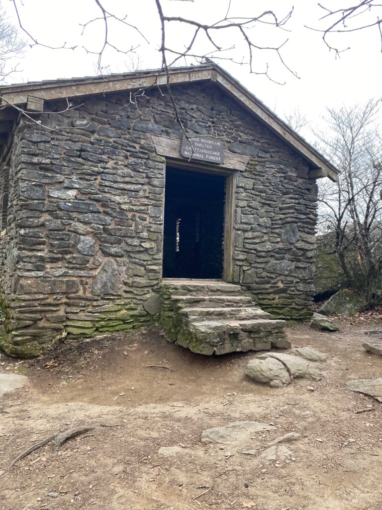
The view at top of Blood Mountain was obscured by trees. There were gaps here and there, but I didn’t pause or walk around the site. Instead, I followed the white blazes on rocks and trees, and eventually these led me downward. I crossed expanses of rock, paused now and then to find the trail, and then it became a matter of bouldering downhill. At times the trail became less rocky, but the descent was for the most part tricky, rife with rocks and roots, and it took me longer than I expected. At one point, where the AT intersected with some other trail, I had to pause and search for a white blaze. Shortly after that confusing moment, I encountered a trail runner. I was surprised, as he was older than myself. He mentioned that he’d just cut through a large fallen tree. We talked for a while about the trail, and how it was poorly marked. He lived nearby, and volunteered regularly to check the trail. I bid him farewell, and continued downhill.
Eventually I saw a road, and then a sign announcing the other side of the Blood Mountain Wilderness. Neel Gap lay ahead. I’ve head people refer to it as Neel’s Gap, as well as Neel Gap. A tarmac road intersects the gap, just like Woody Gap. On the other side is Mountain’s Crossing, a store that stocks food camping items. They also have a hostel. Apparently 25% of thru-hikers quit here.
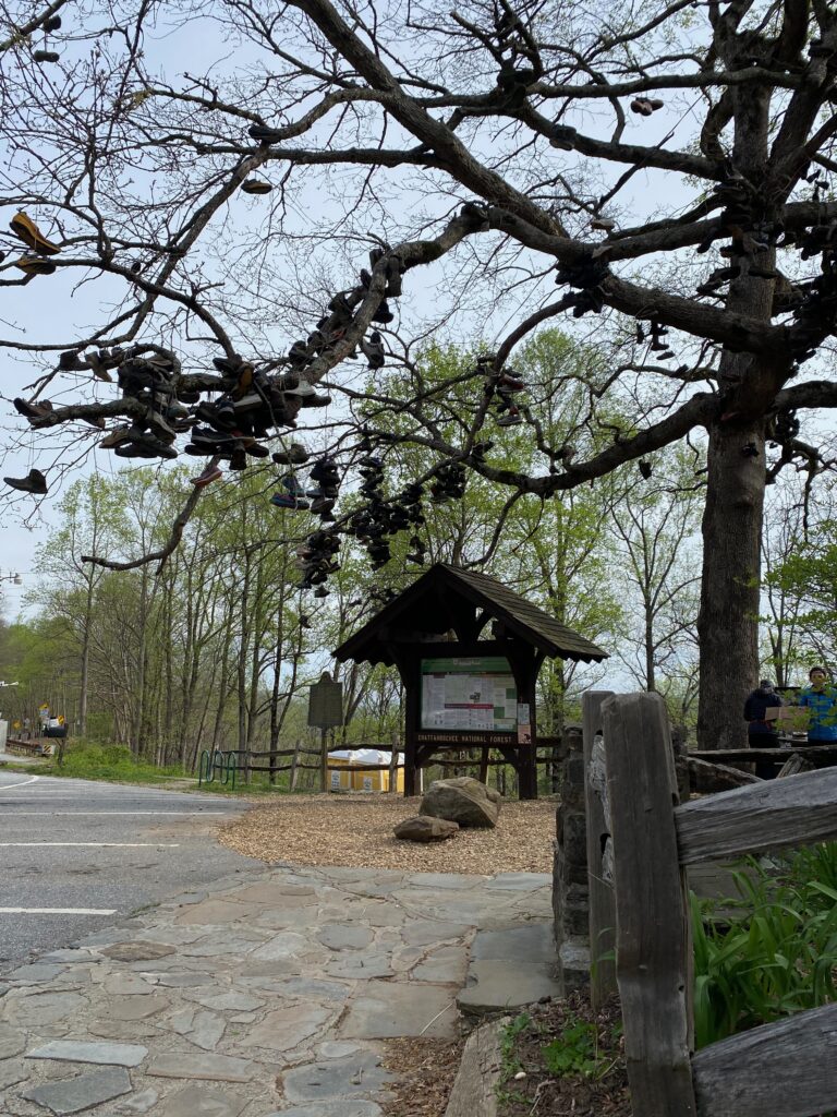
I crossed the road, reaching the tree where many thru-hikers give up and toss their boots and shoes. As a section hiker, and having only brought one pair of shoes, I kept my shoes on my feet. I ascended some stairs, then I dropped my pack outside the building and walked inside. The place looked like a mix of a mini-REI and a tourist trap. There were t-shirts, hoodies, gee-gaws, food, shoes, and other camping gear. I bought two Cokes, took them outside and gulped down the first one. It was 9:30 in the morning, and I was exhausted. I drank the other Coke more slowly, then walked around the store once more. I bought some magnets for my wife, went outside. Someone offered me slice of pizza, but I didn’t think I could eat anything. However, after a while I reconsidered, and realized that I needed to eat something. I bought a small packet of chips and a Sprite. Shortly after consuming both, I threw up, which was far from my proudest moment.
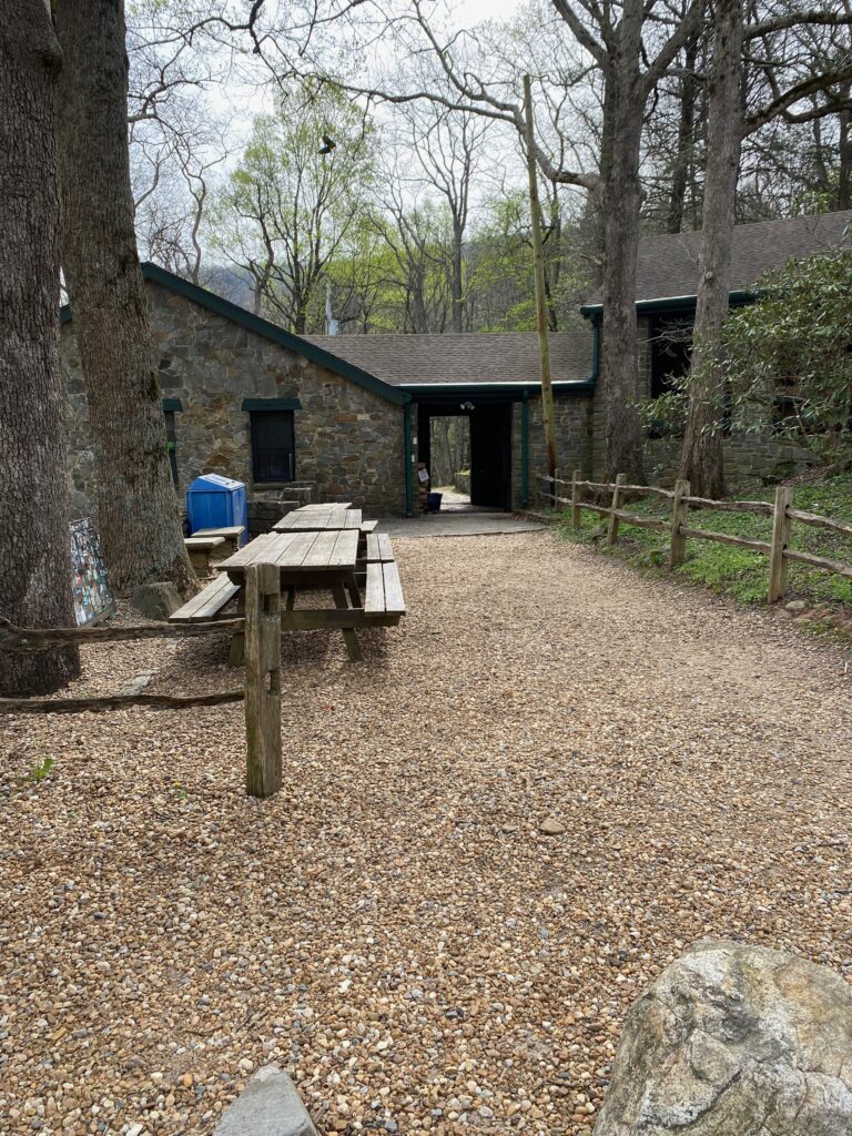
I walked around the building, trying to get back to normal. I placed my slightly used gas canister in the hiker box, along with a lighter. Maybe someone would benefit from those items. Eventually, the thru-hikers who’d camped at Lance Creek showed up, one by one. I greeted the ones I knew. Then, two of the women I’d met at Springer showed up. The other two in their party had quit at Woody Gap and had returned to their starting point in Helen, Georgia. The two remaining hikers planned to continue onward to Unicoi Gap. They’d also been the ones that I’d heard arriving near my campsite at the base of Blood Mountain. Props to them for continuing. They were from Florida, a place as flat as my own home base, or maybe flatter, and had hiked relentlessly up and down each mountain.
At Neel Gap I contacted my shuttle. When I first booked the shuttle, I’d asked them to pick me up at 1pm, as I thought I would camp at Woods Hole Gap, and also that it would take me a while to hike up Blood Mountain. They were dropping off another hiker around 11am, so could get me two hours earlier than planned. I hung around Mountain’s Crossing, and thought about all the ups and downs of the trail, how I had failed to embrace the suck, and how guilty I felt for complaining along the trail. Shortly after 11am, the shuttle driver arrived. It tool an hour to drive back to Amicalola Falls State Park. My car was covered in detritus from the trees. I drove back to the visitor center, dropped off my parking pass, and headed toward the conference on Lanier Lake.

Along the way, overcome by hunger, I pulled into a strip-mall, where I found a pizza place. I ordered more than I could eat, took the rest with me, and got back on the road. At the conference center, I spread my camping gear over one bed. Over the course of a few days I slowly organized the gear into my backpack for the return flight.
Would I change anything? Yes. I should have taken longer breaks, and worked more on my food intake. I now know that the Appalachian Trail involves a lot of ups and downs. And I mean a lot. Every “gap” listed on the map means an up and down, or a down and up. This is something that reading blog, books, etc. will not teach you. Watching videos on YouTube is no substitute for the real thing. There is a lot of climbing. At least I was lucky with the weather, as it never rained nor snowed while I was on the trail. It was hot, however, which I didn’t expect for this time of year.
Will I go back? I hope so. I really want to complete Georgia. I want to hike the northern part of Virginia. When? I have no idea. Maybe in 2026, as I tend to plan out things a year or two in advance, and 2025 already has specific goals. Will I complete the entire trail? It’s 2,100 miles or more. Hiking 40 mile sections at a time will not get me there, not with the years that I have left. So, I highly doubt that I will even hike a quarter of the distance. That doesn’t bother me. The trail crosses 14 states. I might walk three or maybe four of the states. So be it.
If you hike the Appalachian Trail, either as a day hiker, a section hiker, or a thru hiker, take a moment to marvel that this trail exists. To anyone who walks the AT, where it’s a mile or the entire distance, take many moments to pause at the fact that this trail exists. I count myself lucky to have been there, even I walked less than 2% of the trail.